We look at how GPS and other geolocation
techniques can pinpoint where you are – and share the information
Geolocation means working out where you’re
physically located on Earth – or, as the case may be, the ocean or air. It’s a
term that could be applied to all sorts of navigation and orientation
techniques, but today it’s mainly used to refer to the capability of mobile
devices and online services to determine the user’s location via technical
means.
There are several ways this can be
achieved. The most reliable and accurate method is via the global positioning
system (GPS), a network of geolocation satellites that’s owned and operated by
the US government.

Geolocation
means working out where you’re physically located on Earth
As we’ll discuss in this feature, though,
there are plenty of other approaches that can be used when GPS isn’t available.
We’ll also look at the implications of
geolocation technologies for personal privacy and security purposes.
The basics of GPS
Historically, geolocation technology has
been driven chiefly by military purposes. Better geolocation means that navies
and air forces can navigate reconnaissance data. Mobile missile launchers and
submarines can then use this information – coupled with accurate readings of
their own locations – to launch precise strikes on targets.
One of the first electronic geolocation
systems, introduced more than a century ago, made use of fixed radio
transmitters in known positions. Ships and aircraft could estimate their
location by tracking the strength and direction of origin of the signals they
received.
Modern GPS works in a broadly similar way.
The radio transmitters, however, are now located in space, comprising a network
of over 30 satellites. Each of these satellites transmits a stream of
information down to Earth, including the current time and the satellite’s own
position on orbit, as determined and maintained by NASA ground control
stations.
One
of the first electronic geolocation systems made use of fixed radio
transmitters in known positions
These signals can be picked up by any radio
receiver that’s programmed to listen on the correct frequency, which is 1.57542
GHz. (There’s also a second frequency that’s used for military purposes, as
we’ll discuss later). On its own, the information from a single satellite isn’t
very useful. However, with so many satellites in orbit, it’s usually possible
to receive signals from at least eight different satellites at the same time,
provided you have a clear view of the sky. Even if you’re just near a window, a
receiver may well be able to “see” four or five satellites.
With information from multiple sites, the
receiver can determine its own location to a high degree of accuracy. What’s
measured nowadays, however, isn’t signal strength, but the time it takes to
reach the receiver. Since radio waves travel at a limited speed (namely, the
speed of light), transmissions received from remote satellites will contain
slightly earlier timing information than those from closer satellites. By
comparing the clock information from different satellites, a GPS receiver can
calculate its relative distance from each satellite’s reported location. By
analyzing the timing data received from four or more satellites – and the known
orbital position of each satellite – the receiver can infer its own longitude,
latitude and elevation. This can then optionally be plotted on an electronic
map to pinpoint a real-world location, or used for navigation.
GPS accuracy
The accuracy of a GPS reading depends on
the accuracy of the satellites’ clocks. Although these are tightly controlled,
they can drift by a few nanoseconds between corrections. GPS accuracy is also
affected by atmospheric conditions, which can unexpectedly delay radio signals.
For these reasons, GPS isn’t perfectly accurate or consistent. However, a
receiver can usually work out its own location to within around 3m, and even in
the worst case, should achieve an accuracy of around 8m.
This degree of accuracy wasn’t always
generally available. When GPS was developed in the 1980s, it was designed to
deliberately fudge the transmitted time codes by small, unpredictable amounts,
causing the position calculated by the receiver to be out by as much as 50m.
this was done to limit the ability of enemy forces to use GPS signals for their
own military targeting, while still providing sufficient accuracy to help
civilian ships and aircraft to navigate.

The
accuracy of a GPS reading depends on the accuracy of the satellites’ clocks
This intentional degradation was dubbed –
in a fine example of military newspeak – Selective Availability. Non-degraded
transmissions were broadcast simultaneously on a different frequency, but these
were encrypted, so they could be accessed only by those in possession of the
appropriate US government decryption keys.
Selective Availability was officially
turned off on 1 May 2000, so civilian GPS transmissions now provide the same
level of accuracy as military ones. Ostensibly, the rationale for disabling
Selective Availability was to support “peaceful civil, commercial and
scientific applications worldwide.”
However, by the time the system was
switched off, it had already been largely defeated by a method dubbed
“differential GPS”. This involved using static GPS receivers at known locations
to analyse the signals received from GPS satellites and deduce what errors were
being introduced. This information could then be used to correct the position
reported by nearby mobile GPS receivers.
Limitations of GPS
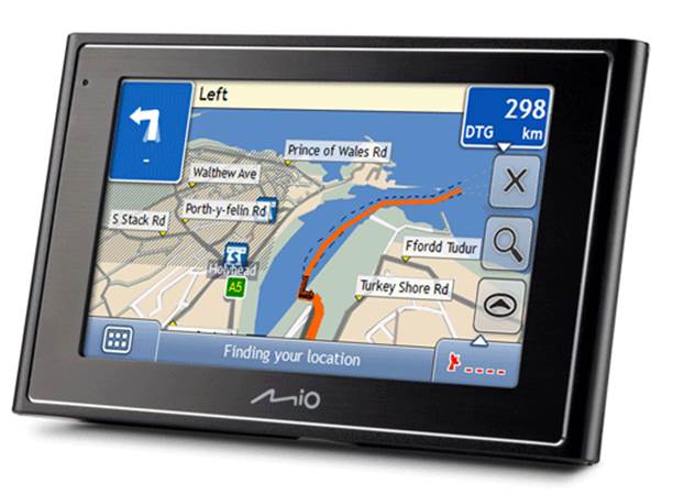
GPS is the most accurate and widely used
geolocation system, but it has limitations. It works poorly indoors, as walls
and ceilings block satellite transmissions. The data rate from the GPS
satellites is also very slow by modern computing standards – only 50bits/sec.
That may not sound like a problem, but when a GPS receiver is first switched
on, it needs to receive a lot of data, including what’s called the “almanac” –
a database containing the status and rough location of all satellites in the
system – as well as more precise timing and orbital data from each satellite,
known as the “ephemeris”.

GPS
works poorly indoors, as walls and ceilings block satellite transmissions
As a result, it can take as long as ten
minutes for a GPS receiver to acquire all the information it needs to work out
its location the first time you use it (or if you’ve moved a long way since
your last fix). Some smartphones work around this limitation with a system
called assisted GPS (A-GPS for short), in which almanac information is sent to
the phone by the network provider, so the GPS receiver can start calculating
its location as soon as it receives ephemeris data from a few satellites.