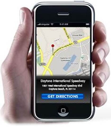
The usefulness of GPS is also limited by
the need for dedicated receiving and decoding hardware. Most modern smartphone
include this, but it’s a fairly recent development. During the past decade,
it’s been more common for mobile phones to use cellular geolocation to
determine their position instead.

Cellular
geolocation works on the same principle as GPS
Cellular geolocation works on the same
principle as GPS, but instead of using the satellite network, it relies on
timing and location data from fixed mobile transmitters. When the phone is
connected to multiple transmitters, accuracy can be almost as good as GPS.
However, as transmitters have a smaller range than satellites, phones may find
themselves within range of only one or two transmitters, leading to very low
precision.
Due to the simplicity of smartphones in
2000, there was also a limit to what could be accomplished with the information
gleaned by cellular geolocation. Typically, the phone’s user couldn’t access
this information; it could be tracked by the network.
IP address-based geolocation
When it comes to laptop and desktop PCs,
neither GPS nor cellular geolocation methods are widely available. If an
application or online service wants to work out the location of its user, it
must use less direct methods.
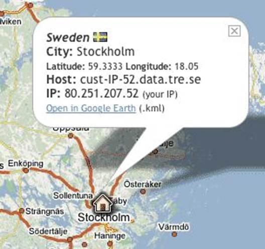
The most widely used technique for finding
the location of a non-GPS-equipped device is IP address-based geolocation –
working out where in the world an internet-connected device is located based on
its external IP address.
This may sound surprising. If you’re
familiar with networking technologies, you’ll know that an IP address contains
no geographical information whatsoever – only routing information for network
traffic. What’s more, a given computer’s address is likely to change
periodically, as ISPs dynamically reassign addresses.

The
most widely used technique for finding the location of a non-GPS-equipped
device is IP address-based geolocation
There are ways of marrying blocks of IP
addresses to real-world information. Whenever a block of IP addresses is
assigned to a service provider by one of the regional internet registries, the
country is publicly recorded.
An online service can easily look up this
information to find the country of origin of an incoming connection. If you’ve
ever visited a US website – such as www.hulu.com
– and been told you can’t access content from Australia you’ve seen this type
of high-level address-based geolocation at work.
It’s possible to obtain a more precise fix
if you dig a little deeper. Every administrator of an IP address or domain name
is supposed to provide contact information, so they can be reached by network
administrators, businesses and even the police. This is commonly referred to as
WHOIS information, after the protocol that’s used for requesting this
information from an internet address.
For individuals, a WHOIS query of your IP
address will usually return the business address of your ISP. So if a web
service knows nothing else about your location, it can use this information to
make an informed guess at your own locale. For services such as regional news
and weather, this may well be accurate enough – a home page for Sydney is a
decent starting point even if you live in Gosford.
For greater accuracy, this information can
be supplemented with collateral data. For example, it may be possible for a
remote server to make guesses about your location by analyzing the route your
data packets take to reach it. If your IP address is similar to another one
whose location is known, it isn’t unreasonable to use that as a clue.
These techniques can, however, lead to
misidentifications, particularly when advertisers try to use them to try to
feign a local presence. For example, low-rent dating sites commonly promise to
hook you up with “single girls in your town” – but in reality, the town in
question may be many miles from where you live (and, to add insult to injury,
the girls probably don’t exist).
Geolocation by Wi-Fi access point
For some purposes, the information that can
be gleaned or guessed simply by looking at the IP address of a connecting
computer may be good enough – but it still isn’t precise enough for properly
targeted marketing, or local services such as traffic reports and cinema
listings. This needs a better way to map private network connections onto
geographical locations.
And there are ways of achieving this. The
key is that, while it’s very difficult to establish the location of a wired
Ethernet connection, wireless networks are an open book.
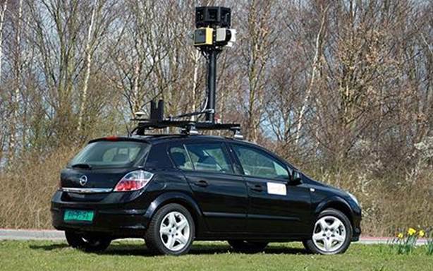
In recent years, Google’s StreetView cars
have been recording not only street-level photos but also reams of information
that’s broadcast by private and commercial wireless routers, enabling the
search giant to build up a sophisticated map of wireless networks.

Google’s
StreetView cars have been recording not only street-level photos but also reams
of information that’s broadcast by private and commercial wireless routers
Now, with the aid of this database, when
Google sees that you’re connected to its services via a particular wireless
router, it can immediately make a strong guess at your location. By factoring
in which other wireless networks your laptop or smartphone can see, your
location can be pinpointed to a degree of accuracy not far off GPS.
If you want to see how effective this
approach is, open up a laptop with a wireless connection – or a smartphone or
tablet with GPS disabled – browse to Google Maps and click on the “locate”
button the small unmarked square directly below the directional scroll pad at
the top left of the map window). The map will zoom in to show the street from
which you’re browsing, and may be able to identify the building. Try the
experiment on a desktop PC with no wireless connection, and Google Maps will
probably only be able to guess at the city in which you live, or possibly even
just the country.
If the idea of a big company sending out
cars to record all this information sounds creepy, it hasn’t been without
controversy. Regulators in the US, Europe and Australia have investigated the
practice, especially over concerns that individuals’ unencrypted traffic may
have been recorded.
In fact, the cars aren’t even necessary –
Android devices on which the Location Services feature is enabled periodically
check in with Google to share their GPS location. They also share information
about nearby wireless networks, keeping the location database updated – and
Apple’s iOS devices work in just the same way.